NORTHEND FARM
THE LEVERSTOCK GREEN CHRONICLE
A detailed history of one village in Hertfordshire, UK
Click to link to the following
This page was last updated on: April 21, 2018
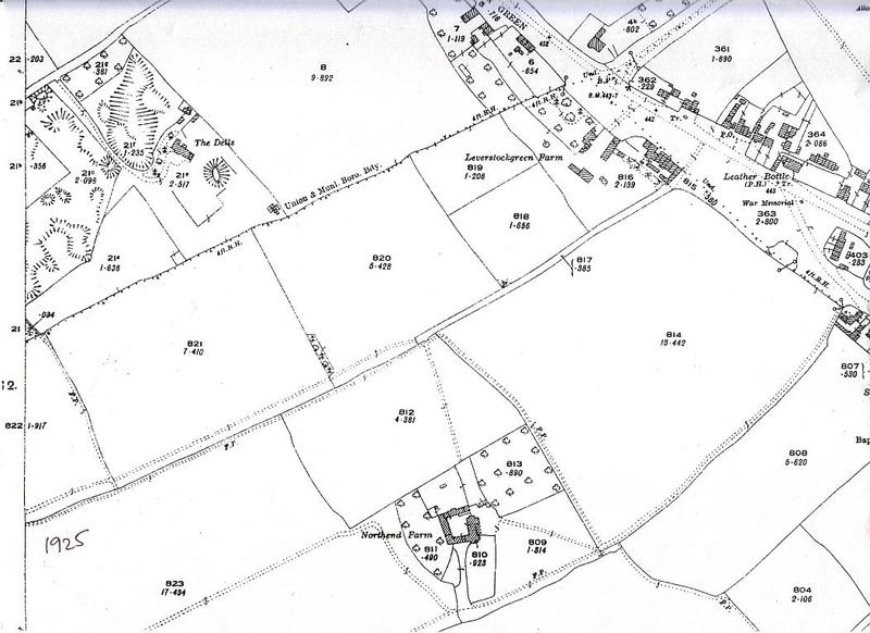
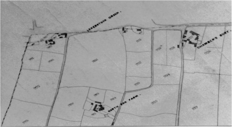
O. S. map extract 1925 showing Northend Farm and central Leverstock Green.
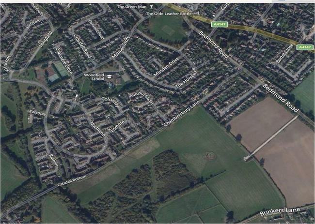
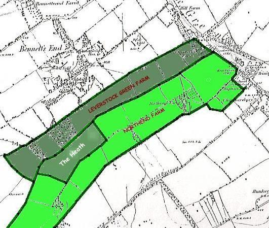
Northend Farm was situated where Woodfield School is today,(see green arrow on map)and was a casualty of New Town Expansion. However, the Northend Farm estate, which bears its name, was for the most part not built on land belonging to Northend Farm at all, but further to the S.E., between Northend Farm lands and Chambersbury Lane as can be seen in the aerial view below if compared with the net map down.
I was fortunate enough to record an interview with Mr. & Mrs Isons of Curtis Road in about 1992. Both of them had strong links with the farm as Mr. Ison’s father Alfred, had been the tenant farmer at Northend from 1933 until his death in 1960, his son, and later his daughter-in-law, helping him on the farm. Mrs. Ison, as well as coming to live at the farm when they married, also knew of the farm from her mother, who had moved to the farm as a six year old when her father had taken over as Bailiff for Mr. Bailey of Chambersbury, the then owner. This would have been in about 1898, as Ethel Ison died in December 1953 aged 61. According to Mrs Ison the farm was much the same when her mother knew it as when she did. Sadly they had no photographs of the farmhouse.
Hybrid 2015 map showing the northend Farm Estate and surrounding area including Woodfield School.
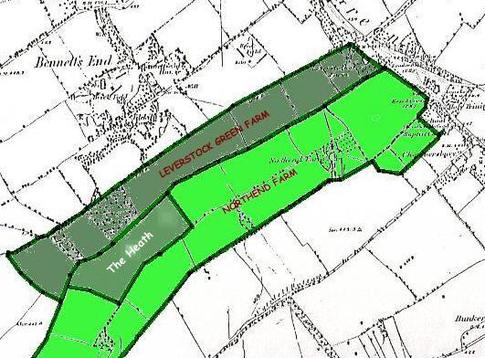
The farm land itself in the Ison’s day, covered 72 acres – a long narrow strip of land running from the front of Leverstock Green (the present day Green was mostly part of the large field at the head of the farm), more or less down to the George at Nash Mills. The width of this farm can be seen on the map of Northend & Leverstock Green Farms to the left. It was between the two tracks or paths, one which corresponds more or less with today’s Peascroft Road and Malmes Croft, and the other follows the line of the “Cart Track”, the top part of which is still in use as a footpath running between the Bedmond Road and The Horseshoe, and which follows the path of “Crossways” by the green, running up eventually by the Cricket Pavilion. This can be seen quite clearly on the 1840 Tithe map extract below which shows the track going past the farm, then swinging right (NE) then left (N) and coming out on the Bedmond Road.
Map showing Relative Position of Northend and Leverstock Green Farm Lands 19th/early 20th centuries
Map Extract from the 1840 Tithe Map of Abbots Langley, showing North End Farm and Chambersbury.
These tracks themselves follow the same line of the previous Iron Age, Saxon & Medieval field boundaries. It was unclear from what the Isons said whether or not their holding included “The Heath”, the large field opposite “Hob Jo Wood” which protruded into this narrow strip, and which had from at least the 16th century until 1841 been part of Leverstock Green Farm. In addition to their narrow strip, they also occupied 8 acres behind the Rose & Crown they called their Cow Meadow, where they grazed their cattle and the two work horses Blossom & Bertha.
The farmhouse dated back to the 16th century or earlier, and from the description given by the Isons was a typical half timbered 16th century farmhouse. It had two large beams running across each ceiling, and cruck ends to the house. Large inglenook fireplaces stood back to back on the ground floor, typical of the new type of farmhouse being developed in the 16th century and which made use of brick chimneystacks. There were 3 reception rooms with inglenook fireplaces, two of them back to back – the third probably being a later extension. The Big Parlour was only ever used on high days and holidays and the stairs went up out of the front room to three upstairs bedrooms. The walls were made of what Mrs Ison described as lath and plaster which I take to have been wattle and daub. There were numerous outbuildings including a dairy, and there were substantial gardens and orchards where the Isons grew walnuts. A relatively recent well had been dug round the rear of the farmhouse, and this water was used for washing.
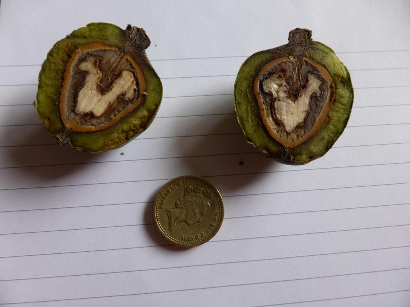
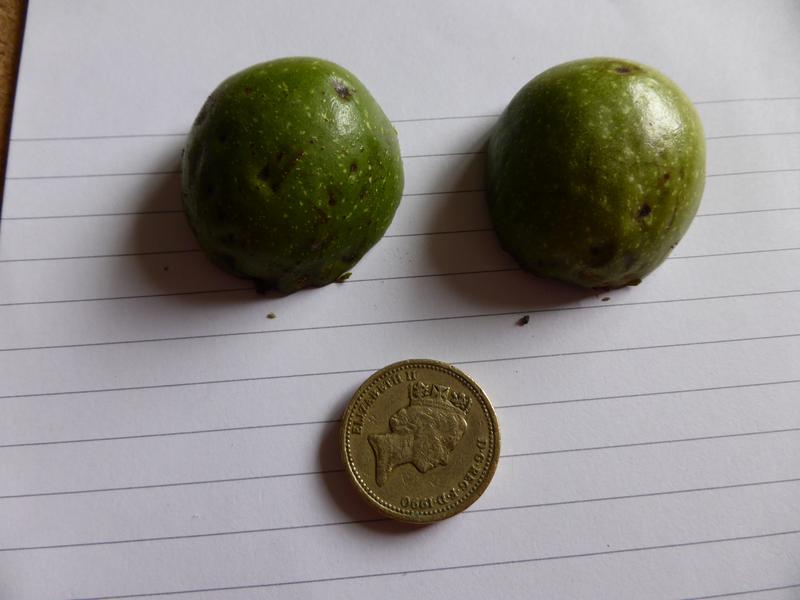
[In July 2015 whilst walking home from church along Malmes Croft, I noticed a tree outside Woodfield School which I did not recognise. Its developing large globular fruits made me think it might be a walnut, left over from the days of the Isons' commercial Walnut grove. Despite having walked along this road hundreds of times over the previous 30 years, neither of us had remarked on the tree before! To identify the tree we took a single leaf and found that it was indeed a walnut. - which meant the tree itself maybe 60 years old or may have grown from s nut buried by a squirrel in the 60s! A few weeks later, the fruit still not fully ripe, we picked one of the fruits to see at what stage they were at. The picture below shows this nut cut in half. The walnut itself was still too soft when probed to be ready for harvesting, which is usually about the end of September, early October.]
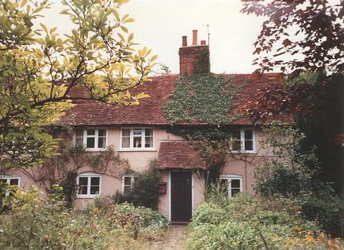
Northend Cottage, Bedmond Road (Photograph by Barbara Chapman) Grade II* Listed
THE NORTH END OF THE PARISH OF
ABBOTS LANGLEY.
Northend Farm and Northend Cottage got their name from being at the most northerly end of the parish of Abbots Langley. The Isons’ Farmhouse and Northend Cottages date back to the 16th century, but undoubtedly there had been some dwellingS in the vicinity earlier than that as in 1355 the residents of “Northend” are referred to specifically in the records of the Abbey of St. Albans, when a court ruling was given in which:
"All villein tenants of Northend are accustomed to carry the timber by water, whenever the mill or the flood gates want repair, though not for the mill house; and all the tenants of Northend, whether majors or minors, mud the mill pond and repair any damage to the mill pond whenever necessary. They also ought to build up, at their own expense. and without allowance of other works, all the earth works round the mill and the flood gates”
[Abbots Langley by S.G. Thicknesse; published 1946 by Staples Press, St. Albans].
N.B. "accustomed to carry" in this medieval context means that it was the custom for the tenants (most of whom were not in fact tenants as we know the term today, but were in fact serfs of the Lord of the Manor i.e. the Abbey of St. Albans- and they had no option as serfs but to do the work.) Where there might have been the occasional copy-holder who paid rent to the "Lord" he or she too would have been obliged to do the work on the mill.
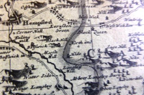
The earliest published map which I have come across showing Northend (just Northend, not Northend Farm), is Sellers map of Hertfordshire in 1676 (extract left) and we know from Abbots Langley Parish registers that members of the Longe family lived at Northend for much of the 17th century. Sellers map is not highly accurate but does show how High Street Green and Leverstock Green were both “Green Roads”(ie ancient Roman Roads, flanked on either side by common land), and shows Northend within the parish of Abbots Langley between Nash Mills (SW) and Black Queen (later to be known as Blackwater Farm, off today’s Blackwater Lane). The Isons’ description show Northend Farm to have been 16th/17th century, and Listed Northend Cottages, which still stand opposite Holy Trinity Church, also date back to that period.
ABOVE:
An extract from John Sellers map of Hertfordshire,
1676
Despite being said to be "actually surveyed and delineated" by Sellers, Leverstock Green is marked as Levesden Green.West Wick would have been what we today know as Westwick Cottage, and West Wick Row is shown where the lane meets the St. Albans Road, rather as the lane which eventually led to what we today call Buncefield Lane. From Hedgerow surveys both lanes are known to before the Norman Conquest.
One early entry from the St. Lawrence’s Church Abbots Langley's register shows that “Henrie Longe” and “ Sarah Lovesaye” were married on 5th February 1626/27. Henry Longe was from Northend and his family had been there from about 1567. Sarah had been born in 1590, third child of Thomas Lovesey and Alice Gardner. Sarah's father was to take over as Bailiff of Hemel Hempstead when Roger Partridge died in 1628. Sarah was obviously an active and healthy lady as she was mentioned as owning land belonging to Northend Farm in 1676, when she would have been 86. [St Lawrence’s parish registers; HALS 80745, and The History of Hemel Hempstead]
By the end of the 17th century Northend was associated with the Asslin and then the Lea families, and their tombstones tell us that Daniel Lea of Northend died aged 72 in December 1712, and that Sarah, wife of Daniel Lea of Northend, died aged 31in December 1726, though she was presumably the wife of the first Daniel’s son of the same name. The farm had passed to the Goodall family by the late 18th century, and in April 1789 Joseph Goodall of Berkhamsted made a will in favour of his son, leaving him Northend Farm:
".....I give and Devise unto my eldest Son William Goodall and his heirs for ever All that my..........Copyhold Estate situate and lying and being within the Manor and parish of Abbotts Langley commonly called or known by the name of Northend Farm, now in the Tennure or Occupation of Abraham Aslins....." [HALS AH 243]
In the early 1900’s Henry Smith of Northend Farm, a farmer, and Joseph Smith of Leverstock Green, his son, acquired the lease on Leverstock Green Farm. It is unclear whether or not Mr. Smith senior kept his interest in the neighbouring Northend Farm, or if the two farms were managed together as one unit. Their lease was renewed in 1839 for a further 9 years, but with an increase in rent. [HALS 80784] The Tithe Survey and the 1851 census showed members of the Smith family still to be at Northend.
By 1881 the farm was held by George Snoxhall and his wife Elizabeth and their five children, with a further change shown in the 1901 census with Thomas and Hannah Childs and their 6 children in residence.
In 1902 the farm was the scene of the Coronation Celebrations for the village, the following being announced by Thos. Childs in the Gazette: with “……..At 12.30 a dinner will be provided at Northend farm for men and boys over 13, Athletic sports commence at 2 pm, and a tea will be given to all inhabitants at 4. At 9.30 there will be a procession to the green and a bonfire will be lit at 10……” A shame that the farmhouse itself was to end as a huge bonfire over 60 years later.
N.B. If you have any photographs of any part of Northend BEFORE or during the actual development into the New Town Estate, or of the 1902 Coronation Celeberations, or of members of the Isons family or any other Northend Farm House residents, please contact me.
thank you
Barbara Chapman
Tennant farmers, the Isons originally rented the land from Percy Webster of Sibley’s Orchard, & later his son Malcolm Webster of St. Michael’s End; but from about 1947 the land was compulsorily purchased by the New Towns Commission, and they were only given yearly contracts from then on. However, the Isons remained at the farm until Mr. Ison senior’s death in November 1960. In the intervening 14 years the Commission gradually removed more and more of the land for development, commandeering fields at no more than a month’s notice. Not long before Mr Ison Senior’s death, work had started on developing Malmes Croft.
With Alfred Ison’s death the tenancy was lost and the farm buildings were left to fall into disrepair. They had in any case, been neglected for some time as the landlords (the NTC) had earmarked them for re-development! Once vacant the farmhouse and buildings were frequently vandalised, and eventually when the time came to redevelop the land, the farmhouse was deliberately burnt down as the easiest way of demolishing it.
The farm was a typical small mixed farm of the time, running some cattle, pigs and poultry, and growing wheat, barley and potatoes. They also had orchards of walnuts and many different apple types. Apart from the orchards, and the small amount of grazing, at any one time there would usually be 2 acres mangles (turnips), 2 acres swedes, 6 acres potatoes and the rest would be down to corn (mostly wheat and barley).
Norman Ivory remembers::
"The Green at that time was much smaller than today. Where the Green today is big enough to play cricket on and stretches back to the road where the estate of houses were built in the 60's.
When I was young there was a hedge row across from the big leaning tree that is still there today and the pond not there today, to the Blacksmith Cottages. The other side of the hedge was a field belonging to Isons Farm that is probably gone now as well. The first money I ever earned was when I was five years old picking up potatoes and putting them in sacks after the spinner had thrown them out of the ground. Many people from the village would collect to do this and I joined in and on the insistence of some of the women there the farmer gave me two shillings - I was very proud and happy and took the florin home to my Mother."
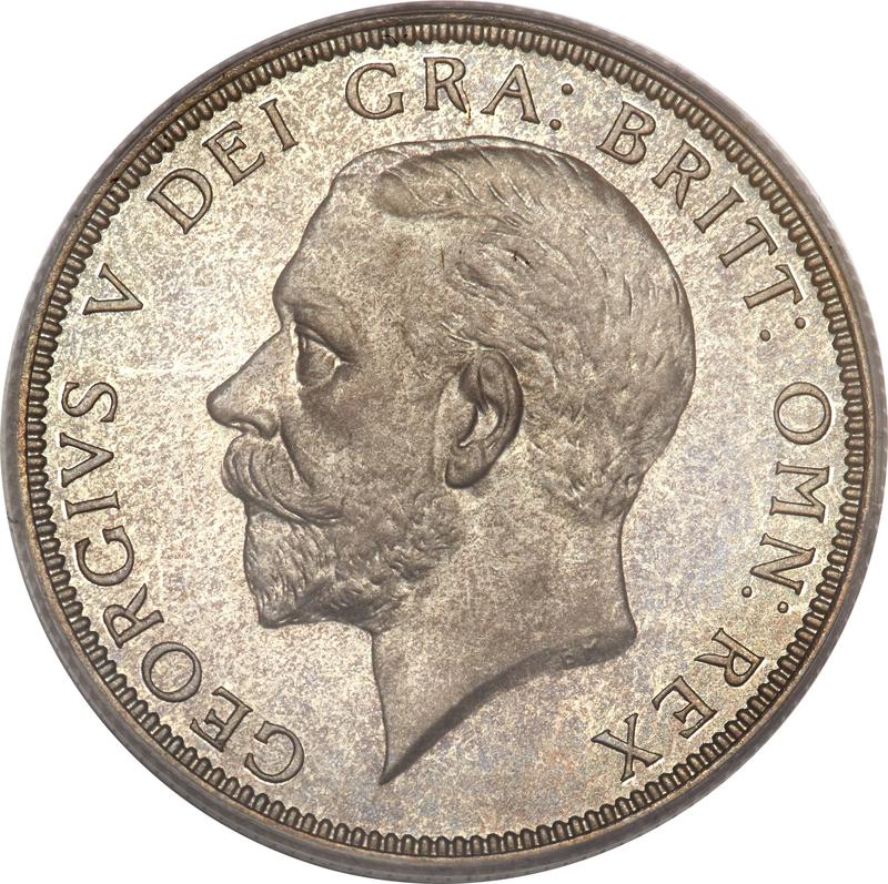
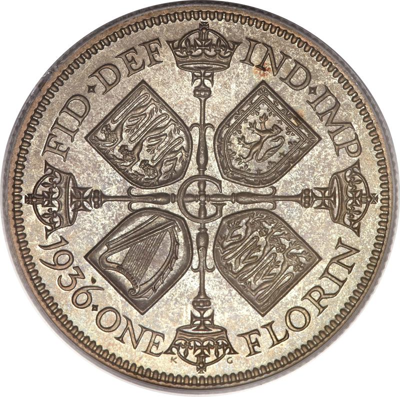
A 1936 silver florin (i.e. 2/- [20p - worth upwards of £1.30 depending on condition and silver prices at time of sale. ]
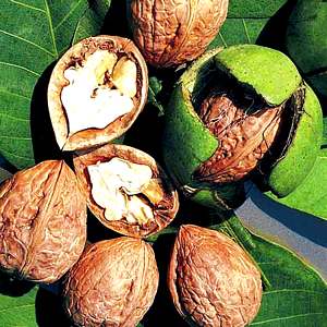
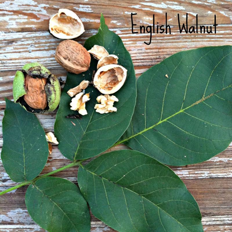
Click on the these photos to find out more about the English Walnut, Juglans regia
Click on thumbnails to open full-sized images
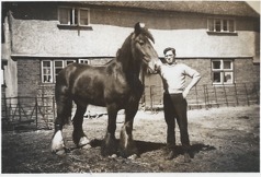
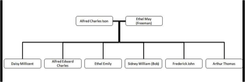
Until 2017 I had not been able to track down any pictures of Northend Farm itself. But then I was contacted via my website by Chris Read, a member of the extended Ison Family. I was kindly shown and given permission to copy and use a part family-tree, (see below) but also a photograph showing BOB ISONS (Uncle Bob i.e. Sydney William) and one of their prized farm horse in front of the farmhouse: See right.
My thanks to Chris for filling a knowledge gap. If anyone else has any information and/or photographs relating to Northend Farm, please CONTACT ME.