Over 22 years ago and before I started my researches, I was told
"Leverstock Green doesn't have any history."
I have proved this is about as far from the truth as you can get.
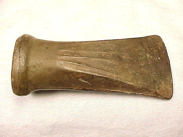
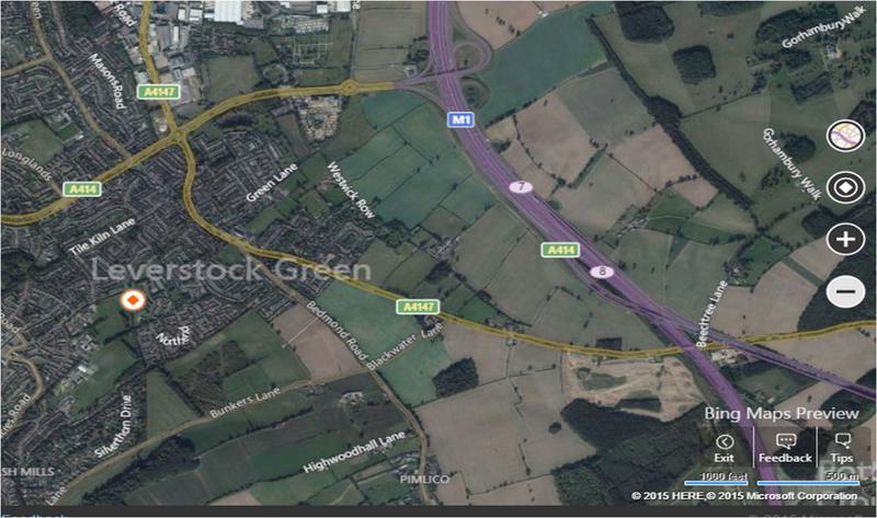
The area around Leverstock Green has from prehistoric times, been subject to human occupation. Palaeolithic flint axes, evidence of an Iron-Age settlement and a Bronze-Age horde (found by Sir John Evans along Westwick Row), have all been discovered in the area. Evidence suggests that the area around Westwick was of importance from the Iron Age period, and was probably a “suburb” of the Iron Age settlement at Pre Wood. Scatters of flint tools together with the later Roman finds suggest that occupation of this immediate area has been more of less continuous from very early times.
The discovery in August 2001 of Iron Age occupation as well as some Roman remains in a rear garden of Silverthorne Drive on the Longdean Estate, has shown a distinct link to Westwick Row and the probability that the underlying field patterns, still discernable in the early 20th century, owe their existence to Iron-Age settlement. More recent work undertaken during M1 widening, has reinforced the importance of the area during the Iron Age. Roman routes and field patterns were later superimposed upon the Iron Age landscape, but the earlier field pattern was largely reverted to during medieval times and has endured at least in part to the present day. It was, however, the Roman roads through the area that have left us the legacy of our principle roads, namely the Bedmond Road, and the A4147 and their original joint route through High Street Green to Cupid Green.
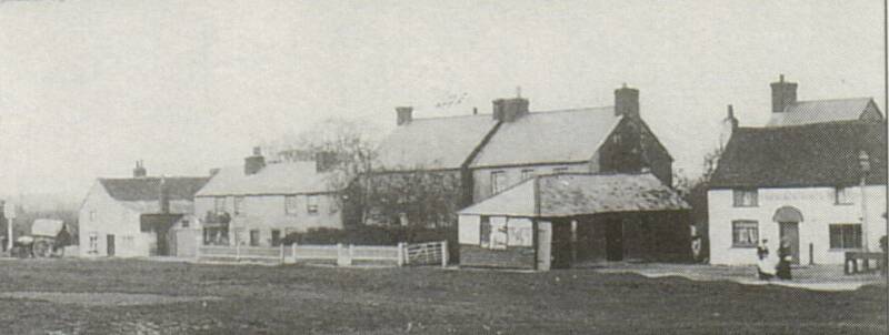
A glimpse at a current map shows Leverstock Green to be part of the sprawling New Town development of Hemel Hempstead and to be within the Borough of Dacorum. This has not always been the case; although it's present size is due to its development as one of the New Town's Neighbourhood Communities. Unlike the other neighbourhoods, however, Leverstock Green was an existing rural village community (much within the Rural District of St. Albans) at the time of its development - and care was taken to try and retain its village character.
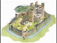
To return to the Romans; as the main roads through the village are of Roman origin, the shape and development of the village owes much to these routes, which are still present if in modern form. Until the diversion caused by the building of the dual carriageway, the more important of the two roadways ran from beyond High Street Green to Bedmond and further. A smaller minor Roman route joined from St. Albans, roughly along the line of the present A4147. Where the two routes converged, a green eventually developed. Other Roman routes from St. Albans passed north of the village linking an important Roman Mausoleum at Woodlane End to St. Albans and Gadebridge. The Romano-British villa estate of Gorhambury is thought to have reached as far west as Green Lane, though with the recent Roman finds along Westwick Row and during the M1 widening, this may have to be reconsidered.
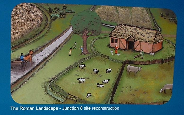
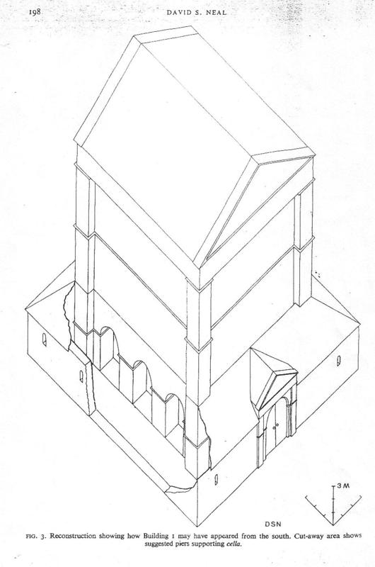
In the summer of 1998 important Roman remains were discovered at Handpost Lodge, Westwick Row, which show that a Roman building, probably a villa, was to be found in the immediate vicinity. It also seems likely that another building was present. As previously mentioned an important site had also been discovered within the area historically considered part of the Leverstock Green District; namely at Woodlane End.
The site at Woodlane End is now considered to be a large temple-mausoleum complex including a large rectangular temple over 15.5 metres high, another smaller mausoleum, a bathhouse complex, an administrative block and a granary. The site of the mausoleum itself was on a Roman route-way linking the principle Roman Road of Akeman Street with Verulamium (St. Albans), via Gorhambury and Gadebridge. It is also likely that the temple/mausoleum at Woodlane End would have been visible to and from another mausoleum discovered in 1992 in St. Albans, near to the City Hospital.
Romans
David Neal's sketch of the temple/mausoleam found off Woodlane End
Prior to the development of new houses at the Handpost Lodge Site further archaeological work was required. Unfortunately the developer “jumped the gun” and began work without calling in the archaeologists. Following a High Court Injunction in February 2000, the archaeological team was brought in, and it is clear from what they did find that there was definitely a high status Roman settlement on or very nearby the site, and that they also found evidence of Iron-age occupation.
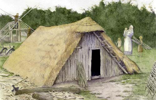
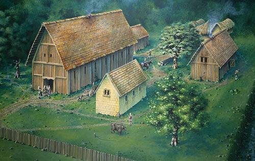
In Saxon times the manor of Westwick was established, having boundaries thought to be similar to those of the Roman villa estate of Gorhambury, and therefore covering most of the village and surrounding farmland of Leverstock Green. However, in light of the new evidence to suggest a villa site in Leverstock Green itself, Roman estate boundaries may have to be re thought. In the 10th century a Saxon Charter gave the manor of Westwick to St. Albans Abbey. Close inspection of all available maps shows that most of the local field systems were certainly well established by the time of the Norman conquest, and were therefore at least of Saxon origin – but it has also recently suggested that they may indeed predate the Romans as in several instances the supposed line of the Roman Road cuts across the old field boundaries. If that is correct then many of the field boundaries around Leverstock Green could date back to Iron Age times, and this area may have been an important hinterland for the Iron Age Opidium at Pre Wood. The recent findings at Silverthorne Drive reinforce this argument, as do the crop-marks shown up by aerial photography. A hedgerow survey undertaken in September 1994 along the hedge in Chambersbury Lane dated the hedgerow to the early 10th century. The lane was already known to be an ancient one, and a more recent survey along Pancake Lane has produced a similar date.
Reconstruction of typical Saxon Hall House and outbuildings.
from
storyofbeowolf.blogsot.com
In the Middle Ages the road from St. Albans (now the A4147) was established as the principle route to the growing settlements of Hemel and Berkhamsted from London. Berkhamsted being of particular importance with its Norman Castle, a royal residence not abandoned until the late 15th century - The road was known as the Berkhamsted Way or the Berkhamsted Highway. It wasn't until the development of the Turnpike Roads in the 18th century that it became more of a local route; although there was no village of Leverstock Green during the Middle Ages (instead the main settlement was at Westwick, along Westwick Row). Settlement in the area was generally made up of regular well spaced individual farmsteads rather than nucleated villages.
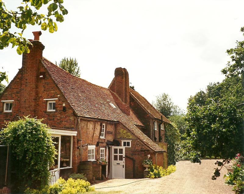
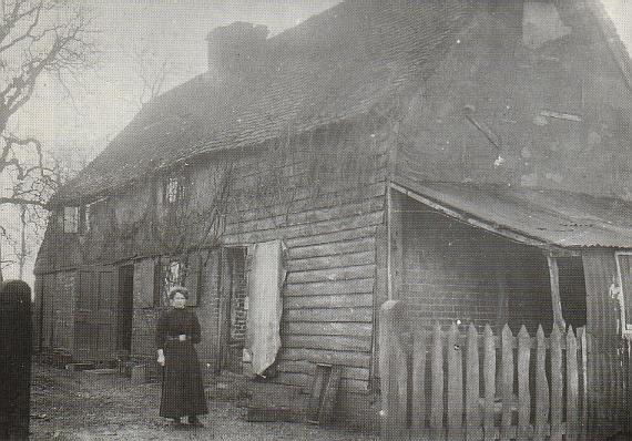
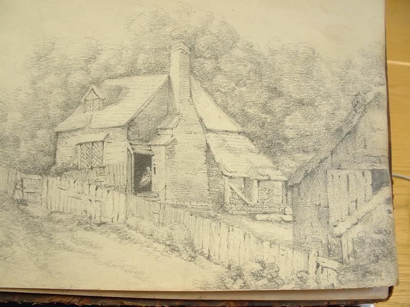
One of the oldest recorded farmsteads was in the centre of today's village was Stonards. This property is known to have existed from at least the 13th century to the 16th century, and was to be found behind the present day “Green Man” previously called “The Litten Tree” & “The White Horse”. Even more remarkably, Westwick Cottage along Westwick Row, has now been proved as a result of dendrochronology tests to have been continuously inhabited since the late 12th century, and was very probably the original manor house of the manor of Westwick. It now has Listed Grade 2* status. Unfortunately a geophysical (ground radar) survey undertaken by LGVA in the 1990s failed to show any further evidence of the earlier medieval building complex on the site. This despite the fact that Sheila McQueen had reported to me that when she and her husband first moved in and set about landscaping the gardens etc. in the 1950s they had carried away literally dozens of wheelbarrow-fulls of old pottery, and other items. Sadly interest in our heritage was not as great in post-war Britain. It is possible, in my opinion, that if it were possible to fund a full geophysical survey of the area around Westwick Cottage today, that the amazing development in the technology used might just show things which were not possible to see 20 years ago.
Westwick Cottage
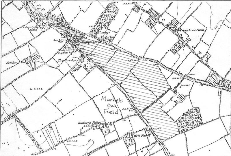
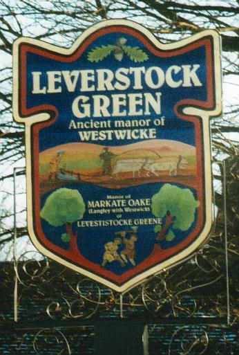
Leverstock Green was from the middle ages to the early 19th century the name given to the area of green (that is common grazing land) that had developed at the junction of the two roadways, (Berkhamsted Highway and what is now Bedmond Road) and which continued in a wide verge on either side of the road as far as High Street Green. This can be clearly seen on the map. By the 17th century the small manor of Market Oak (or Markate Oake) was also given the alias Leverlestock Green. This manor had originally been given to the nuns of Markyate Priory (hence the name Markate or Market), and stretched roughly from the site of the present Church in between the Bedmond and St. Albans roads, to just beyond Blackwater Lane.
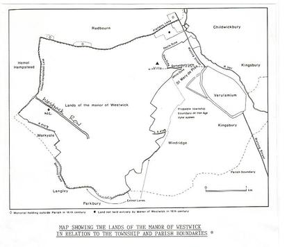
Westwick is now officially recognised as a Shrunken Medieval village. Originally it was thought to have been centred around Gorhambury, with the focus of settlement shifting to Westwick Row by the mid 16th century at the latest, though probably earlier. However, recent research (mostly instigated by my researches) has now shown that the main settlement of Westwick, (Saxon and Medieval) and indeed possibly the original 12th century Hall built by Geoffrey de Goreham, to have always been centred around Westwick Row, and developing outwards to incorporate the later medieval, Tudor and present-day sites at Gorhambury. The fullest extent of the "vill” being possibly during the 14th century, with it then shrinking back to being principally those dwellings off Westwick Row - Gorhambury developing it's own separate identity, which was reinforced after the building of Sir Nicholas Bacon's Gorhambury in 1563.
Westwick Manor
Base Map of the Manor of Westwick reproduced with the permission of Jonathan Hunn from his
"British Archaeological Reports:
British Series 236, 1994."
Westwick Row added.
Berkhamsted
Westwick St. Albans
London
BERKHAMSTED HIGHWAY
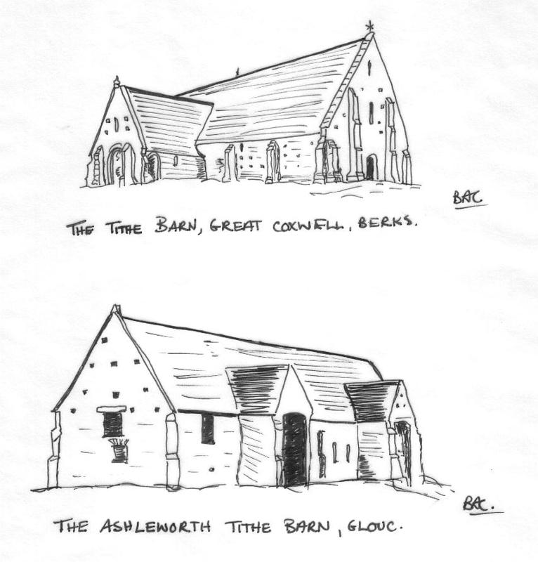
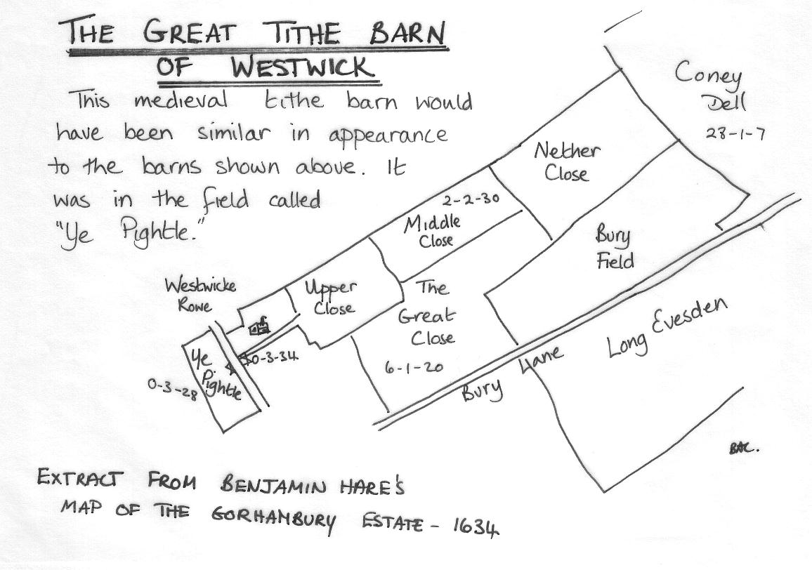
Considerable documentation exists showing that for many centuries the concentration of individual farmsteads and labourers tenements along or immediately off Westwick Row was the principle focus for settlement, and until its demolition in 1633 a great tithe barn was to be found off the Row more or less opposite today's Westwick Warren.
However, that does not mean to say that there was no settlement elsewhere. From the beginning of the middle ages the whole area was cultivated, and many records exist to tell us the ancient names of the various fields. In fact the pattern of field boundaries and lanes was well established, so that the roads, lanes, and many of the field boundaries shown on the mid-19th century O.S. maps had been relatively unchanged for centuries. A remnant of medieval strip farming can even be seen on the 1872 map in the narrow boundaries of Winchdell Common off Bunkers Lane.
By the early 17th century we know that the principle farmsteads in the area were well established, and documentation shows a thriving community with many long established yeoman families; although at that time the market centres were in Hemel, Abbots Langley and St. Albans. It was also during the 17th century that the Grimston's, as Lords of the Manor of Gorhambury, Westwick, Prae and Leverstock Green, began to improve and consolidate their estate, gradually obtaining the freehold to most of the land within their manors by the end of Victoria's reign.
Settlement
Pattern
A.
B
C
Extract from the 1766 Dury & Andrews Map
of Hartfordshire*
A-B = Berkhamsted Highway (A4147)
C-D = Bedmond Road
Both the above originally Roman Road or trackways.
* as spelt on the map
D
Click the g+1 logo above to a) leave comments and b) recommend this site to Google and/or individuals via their email.
Ecclesiastically from Medieval times until the creation of the Parish of Leverstock Green, the area was divided between three parishes: Hemel Hempstead, St Michaels and Abbots Langley. Politically Hemel parish was in the Hundred of Dacorum, and the other two in the Liberty of St. Albans (and the Hundred of Cashio). Click here for more information. Part of Westwick Row, including Westwick Cottage, King Charles II Cottage & Westwick Row Farm are still within the jurisdiction of St. Albans Council and within the Civil parish of St. Michaels. The few houses in Bedmond Road from Woodfield Drive towards Bunkers Park, and including the properties within Woodfield Gardens and Woodfield Drive are all within the Civil Parish of Nash Mills. The rest of the village is nowadays in Leverstock Green Ward within Dacorum.
By the early 18th century more dwellings had appeared around the green, The Leather Bottle was established, as was a Smithy at the end of the original Blacksmiths Row. Click here for more information (During the 17th century a Blacksmith called Richard Hannell lived at Dell cottage in Westwick Row, presumably plying his trade from his home.) Listed Building status was eventually gained for Dell Cottage in 2002 After I submitted compelling details to English Heritage (Now Heritage England) with help from Architectural Historian Alan Greening.
Early 18th Century
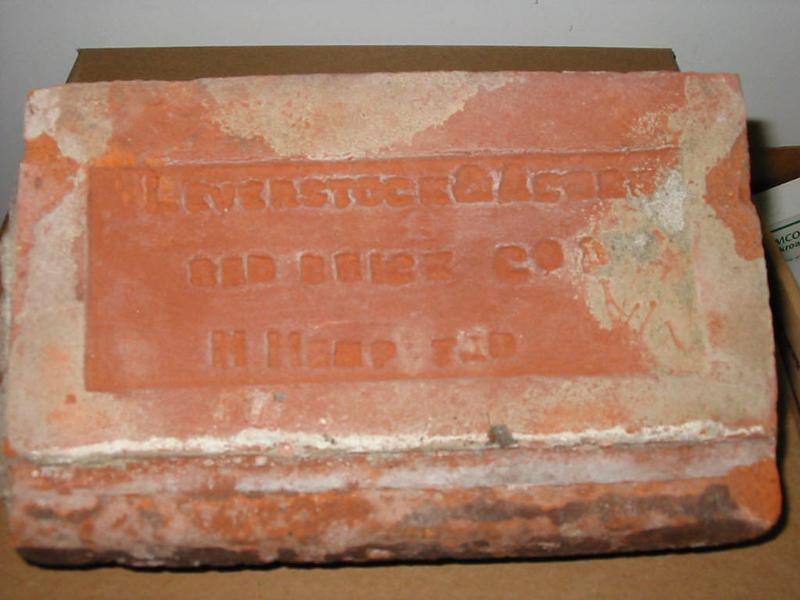
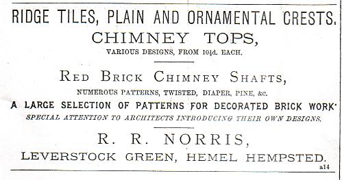
By the time Victoria came to the throne, the small brick and tile making industry centred for centuries at Tile Kiln, began to grow, so that by the mid 19th century brick making was an important local industry, bringing with it an increase in population and the need for a local church; Holy Trinity being consecrated in 1849. The Leverstock and Acorn Brick Co. excavated brick earth not merely from the Tile Kiln Lane/Bennetts End area, but also from the area around Woodlane End that Charles Dickens used as a model for the brickworks in "Bleak House". An area off the present Leverstock Green Way was also a brick field; Pelham Court Flats being built on the site. The few Victorian properties in the village are largely built from "Leverstock Reds".
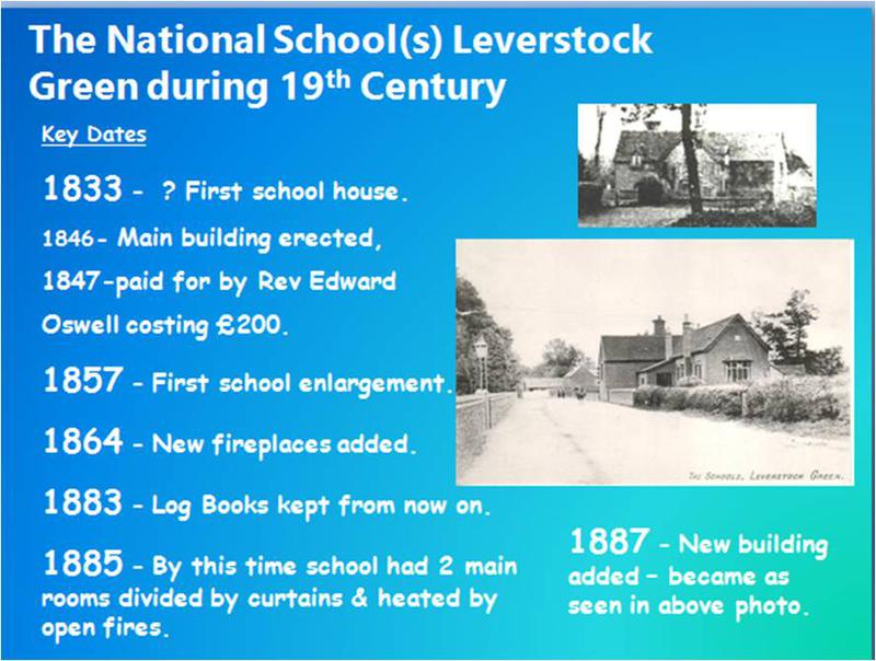
Leverstock Green was fortunate enough to have its own school from the mid eighteenth century. In the late Georgian, early Victorian period, Leverstock Green was fortunate in that it was able to provide some kind of education for the children of the village, either at some of its numerous Plait schools,(e.g. the one run by Sarah Hawkins in the village in the mid 19th century (in 1851 there were 4 schoolmistresses and 1 schoolmaster listed in Leverstock Green.) There was also some basic literacy lessons once a week at the Baptist (Wesleyan) Chapel’s Sunday School, and from very early on at a National School.
1846 the National School for both boys and girls, was built in the village in Bedmond Road, at the expense of the Rev. Edward Oswell, the then 24 year old curate of Abbots Langley. Parents had to pay 2d (worth about 45p today) a week for each child until 1876 when it was then reduced to 1d, and later still made free. The school served children from a very wide area including as far afield as Pimlico and Woodhall Farm. Over the years the school was enlarged twice, but by the mid 1920’s it was both too small and with many faults under what we would today term “heath & safety”.
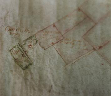
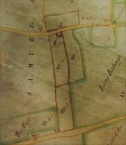
Above left: 1766 map showing the holding of Dell Cottage XIV (3 main fields and the cottage with garden) Above right: 1895 Kiffs Farm (as Dell Cottage was known then). Below, the distinctive chimney at Dell cottage today
This cottage “on Leverstock Green” was sketched by Charlotte Grimston, 1st Countess Verulam in 1807.
After careful study of all the evidence we have, old maps, photographs etc. I have concluded that it was still standing at the time of the Tithe Survey in 1840. The ground plan and other factors lead me to suppose it was the cottage and gardens no 238 on the St. Michael’s Tithe, then 33 years after Charlotte made her sketch, the property was owned and occupied by Thomas Orchard. Over the following century and a half the cottage was extended twice, becoming White Cottage ( corner of Curtis Road) and the very earliest part demolished and eventually a modern garage built, in its place.
Early 17th -18th centuries
For a DETAILED history of all aspects of Leverstock Green's history, visit the three main link pages above: Pre 1900,20th Century & 21st Century.
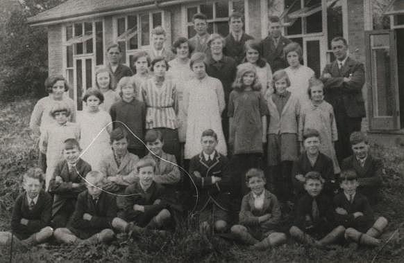
Eventually after much fundraising a new school was built down Pancake Lane on land given by the Earl of ‘Verulam, and in 1930 the children, together with their teachers and all their equipment moved into the brand new light and airy Church of England primary school more or less in the middle of Pancake Wood. With increasing population in the village, Pancake Lane School was also enlarged on more than one occasion. It was a happy school and many, now elderly pupils remember their time there with fondness.
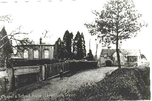
ABOVE 1890 Baptist Chapel and the School House (behind tree.)
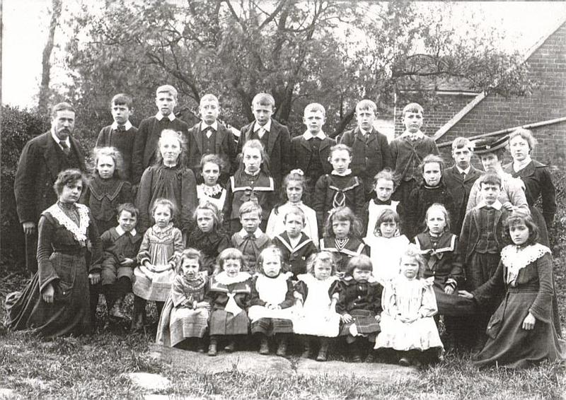
ABOVE1897:Mr Ford (Headmaster), Mrs Ford (in hat) with Student Teachers and pupils at Leverstock Green School.
Walter Ayre (Headmaster) with some of the older pupils at the new school in Pancake Lane, 1930
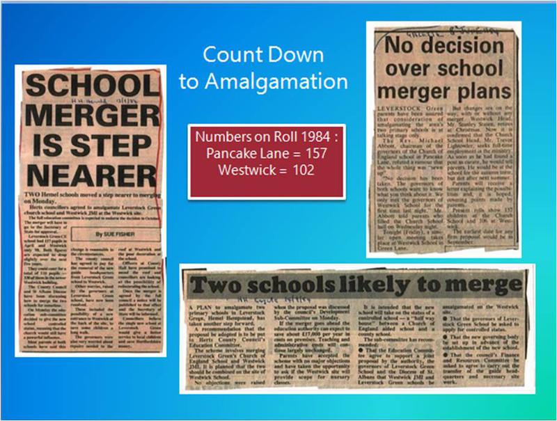
New Town expansion brought with it an increase in village population and a need for a 2nd school, so that by 1962 an additional primary School was built down Green Lane, known as Westwick School. However 23 years later the school population had shrunk and it was deemed necessary to close Pancake Lane School, and create a new school on the site of Westwick School which amalgamated the two schools. Thus Leverstock Green J.M.I. Voluntary Aided Church of England school was born, and opened in September 1985.
Returning to the time Victoria came to the throne, the small brick and tile making industry centred for centuries at Tile Kiln, began to grow, so that by the mid 19th century brick making was an important local industry, bringing with it an increase in population and the need for a local church; Holy Trinity being consecrated in 1849. The Leverstock and Acorn Brick Co. excavated brick earth not merely from the Tile Kiln Lane/Bennetts End area,(Norris's Brickworks) but also from the area around Woodlane End that Charles Dickens used as a model for the brickworks in "Bleak House". An area off the present Leverstock Green Way was also a brick field; Pelham Court Flats being built on the site. The few Victorian properties in the village are largely built from "Leverstock Reds".
Victorian Brickworks
Leverstock Green was, despite the brick industry that continued until the late 1930's, essentially a rural community with its own Church, Chapel, School, Post Office, Blacksmith, general store, Parish Hall and plenty of pubs. Curtis Road was built in 1926 by St. Albans RDC, and other development slowly took place during the 1930's, 40's and 50's. But the biggest changes came with the development of the New Town of Hemel Hempstead. Thankfully however, care was taken by the New Town authorities to maintain the village character of Leverstock Green and with many of the newly developed roads using the same routes as the previous Iron Age/Roman/and Medieval boundaries and tracks.
GALLERY VIEWS AROUND LEVERSTOCK GREEN 1900-1939
click on any image to view
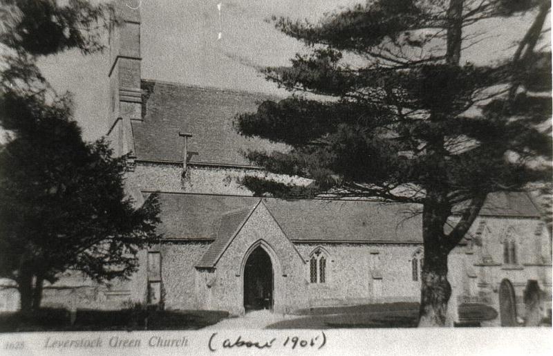
L: Holy Trinity Church 1905
R: A very early photograph of The Vicarage, Pancake Lane.
More Gallery Views from the 1940s to the early 1960s
click on any image to view.
LEVERSTOCK GREEN FARM L: 1954 & R: 1965
photographs by the late Allen Shuffrey
The old Leverstock Green was in effect cut in two by the building of the dual carriageway. Boundaries were redrawn, and new districts of Adeyfield and Bennetts End were created, changing forever the geographical (and political) perception of what is considered to be the area of Leverstock Green. Large residential estates were built and a new village centre was created. The green was enlarged to its present size. Eventually the boundaries of the Borough of Hemel Hempstead (later Dacorum) were redrawn so that virtually all of Leverstock Green is now within its jurisdiction. (Previously much was in St. Albans RDC. – Now just the area of Westwick Row to the A4147 from just beyond Dell Cottage is within St. Michaels.)
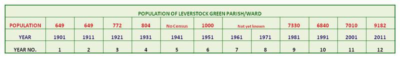
In 1901, when the parish of Leverstock Green was considerably larger in area than today's political ward, the population was 649, rising to 804 in 1931. Since development as a residential area of the New Town, Leverstock Green Ward (which is now confined to just the area this side of the dual carriageway, and is now part of Dacorum Borough) has a population that peaked at over 7,000 in 1981, falling back for a while, but then steadily climbing to its current level. 2014 Population for Leverstock Green Ward was estimated at 9500, making the population for the entire village over 10,000. (Parts of the village are within St. Michael's St. Albans, Apsley and Nash Mills wards.)
Yet despite this development, many residents of Leverstock Green still regard themselves as living in a village and being part of a village community. We have a Village Centre, a Village Hall and a Village Association (LGVA). and many newcomers or visitors to the village comment on its "village atmosphere".
The present Leverstock Green Village Association and Leverstock Green Parish Trust (both registered charities) owe their existence to the fund-raising efforts and generosity of earlier generations of residents of Leverstock Green. On 19th April 1920 the deeds relating to "The Leverstock Green Parish Hall Trust" were finalised and signed. This trust was an extension of that trust which had originally been set up in 1915 when land at the corner of Pancake Lane and Leverstock Green Road had been given by a local farmer/landowner John Knox Hart for the express purpose of building a parish (village) hall. The original intention being that the hall should act as a memorial to those who died in the Great War. However, fund-raising efforts by Leverstock Green inhabitants had begun as early as 1905 as the need for a meeting hall in the village was sorely felt. All manner of events, including the first ever Village Fete and Sports were held in order to raise the necessary money.
Prior to this time the only meeting places in Leverstock Green (apart from the Church and Chapel) were the numerous Ale Houses and Public Houses in the village and the school. Consequently in 1915 an area of land at the corner of Pancake Lane and Leverstock Green Road was conveyed to Trustees for use as a Parish Hall, Club or Institute.
As a consequence of the 1920 Trust, the original modest building on the site was superseded by a more substantial wooden structure, and a hard tennis court. This building was used for just about everything: a meeting place, a public library, a clinic, meetings of local organisations including Brownies, Guides, Scouts etc. and as a canteen/dining room for Leverstock Green School from the time of the 2nd World War. By the early 60’s it was obvious to the Trustees that the original hall was well past its sell-by date, and with the development of Hemel Hempstead New Town, plans were made for a new Village Hall to be built by the Development Corporation.
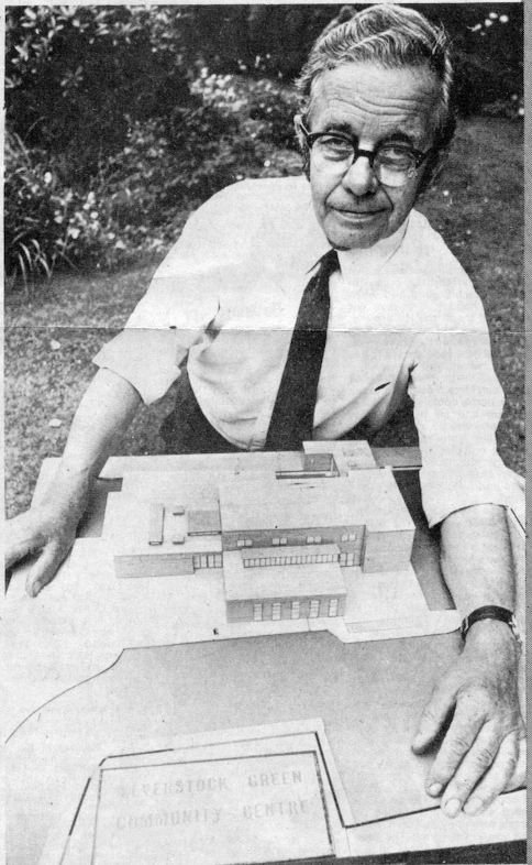
LGVA CHAIRMAN Fred Buglass holding the model for the new Hall 1973.
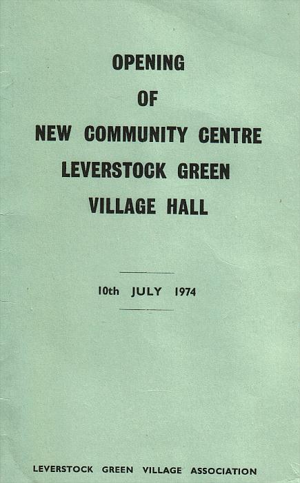
In July 1974 the present Leverstock Green Village Hall was eventually opened, with the LGVA administering the hall. The hall itself has undergone several alterations since then,the most recent being in 2007/8. which was completed at the beginning of 2008. Members of LGVA Committee and other residents were encouraged to think of a way in which they could raise funds towards the building fund. The legacy left by Fred Buglass went a long way to meeting the costs, but other fund-raisers were necessary. Amongst those held were the usual summer fete and later fireworks, a magnificent Variety Show by the LG Players, our bi-annual quizes and a bring-and-buy sale. I wrote a book on Leverstock Green's Lost Properties, the profits of which went to the building fund.
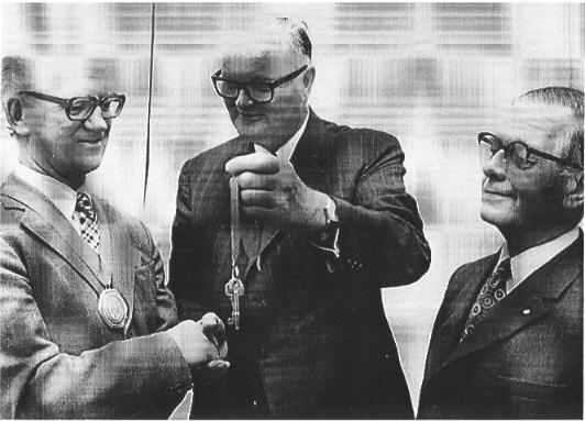
Mr Kirk hands the keys of the Hall to the Chairman of Dacorum District J. Johnson, and later to Fred Buglass as Chairman of LGVA
Village Hall
NB Depending on the size of your screen, you may need to reduce viewing to 90% (do not go any lower as this may cause items to overlap), and make sure the "page bar" at the bottom of your screen is as far to the left as possible.
As can be seen from this bar chart,the population grew considerably after New Town Development in the 1960s and 1970s, peaking at 7330 in 1981 for 20 years, and growing massively again after 2001.
I have as yet been unable to establish the population for the ward in 1961 & 1971, but hope to do so at some time in the future. In addition it is also my intentions to establish the FULL figures for Leverstock Green in 2011 from the Office of National Statistics https://www.ons.gov.uk/ [See item in the box to the right concerning an earlier population of over 1000 in 1855.]
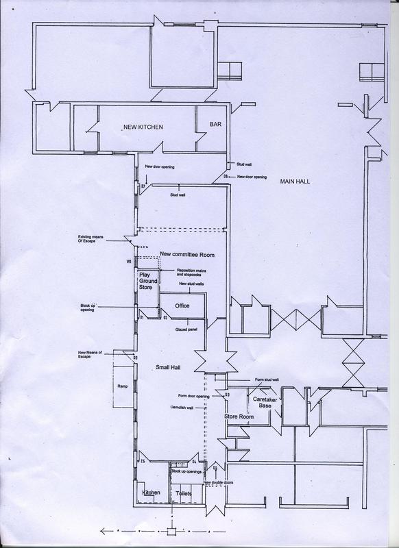
Revised New Hall Plans
Revised New Hall Plans Phase 1 part 2
Phase 1 converted the original Committee Room into a large kitchen and Bar area.
The new kitchen turning anticlockwise to see the whole room.
Click on the left hand image first.
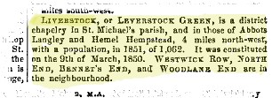
Following the consecration of Holy Trinity Church and the formation of its own large parish, the population at the time of the 1851 census was 746, rising in 1855 (according to the Court Directory above, the population of Leverstock Green Parish as it was then, was over 1062).
At this time not only did Leverstock Green include areas within St. Michael's St.Albans and Abbots Langley, it also covered a much bigger area of Hemel Hempstead than not only today, but also in the 1970s, covering the whole of Apsley, Adeyfield, and much of the eastern part of Hemel Hempstead served by St. Paul's Church (later demolished and the Maternity Hospital built on the site), until it too was demolished for new housing.
With the formation of the new Diocese of St. Albans in 1877 and the subsequent creation of the parish of Apsley the numbers fell, and by 1891 was 712.
FOR FURTHER DETAILS ON THE FINISHED REFURBISHED HALL TOGETHER WITH DETAILED PHOTOGRAPHS,
CLICK ON THE BOX TO THE LEFT, SCROLLING DOWN TO
2005 -SUMMER 2008
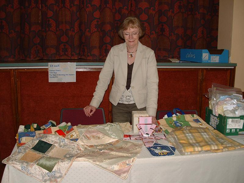
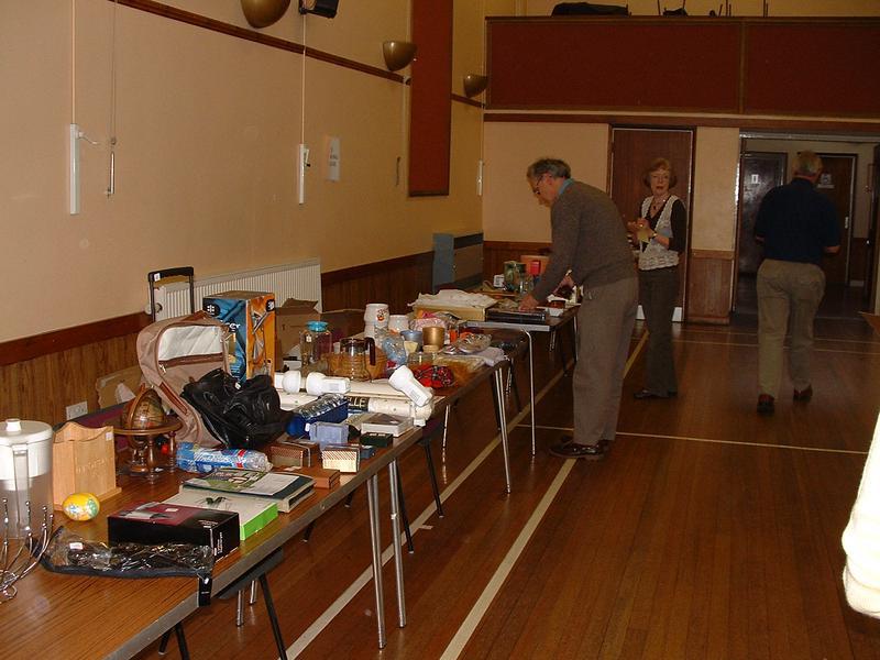
Two photographs taken at the Bring & Buy Sale
SCHOOLS
SCHOOLS
SCHOOLS
PICTORIAL VIEWS
PICTORIAL VIEWS
NEW TOWN GROWTH
In 1987, after consultation with the Charity Commissioners, the land at the corner of Pancake Lane and Leverstock Green Road, owned by the "Parish Hall Trust" was sold. It was also decided that the name and purpose of the Trust should change, although the Trustees should remain the same. Fortunately the land was sold at the height of the property boom and the proceeds of the sale invested in Trustee Securities. Owing to considerable red tape it was not until March 25th 1992 that the new Trust Deed was completed, and the new Trust could be operated. Since then the Trust has funded many projects, events and activities within Leverstock Green. Both the Constitution of LGVA and the Scheme laid down by the Charity Commissioners for the Leverstock Green Parish Trust are based on the original Trust Deed of 1920.
Leverstock Green residents are supportive of their community and concerned in preserving its long heritage. It should also explain why we do not just think of ourselves as being part of Hemel Hempstead. We have a very strong community spirit that is very firmly rooted in our historical past and the rural community that existed as a recognised separate village from the eighteenth century, and a cohesive community from Medieval times. In addition, the basic infrastructure of our area is almost totally medieval or Roman in origin, and this has had a strong influence in maintaining the community spirit of the area. This is a heritage which those of us actively involved in the community are determined to preserve despite recent changes, and proposed new buildings within the area.
A full and detailed account of Leverstock Green’s History can be found at www.lgchronicle.net
Barbara Chapman - updated 9 March 2017
TEN FACTS ABOUT THE VILLAGE HALL YOU MY NOT KNOW!
1. The hall is run by the Hall Management Sub-Committee (HMSC) which reports to the Leverstock Green Village Association (LGVA) Main Committee (Trustees). If you are interested you may volunteer to join the HMSC without becoming a member of the Main Committee.
2. Groups who hire the hall regularly can nominate a representative to join the main committee.
3. All LGVA committee members are volunteers.
4. LGVA lease the hall from Dacorum Borough Council (DBC).
5. DBC do not provide any funding towards the running of the hall.
6. Finance comes from hiring fees, supplemented by fund raising events.
7. The Parish Trust, under its terms of reference, provides finance for routine maintenance.
8. The hall is a popular venue for weddings and parties. Many annual events take place there.
9. Forty groups regularly hire the hall every month.
10. On average over 1000 people use the hall every week.


")


")


 on the Village Green in 1940s")