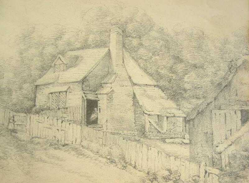
In undertaking some research at HALS on Church Cottages Leverstock Green, I came across this sketch, executed n 1807 by Charlotte Grimston, 1st Countess of Verulum HALS ref: D/EV/F98.[A2A]. (Reproduced here under licence from HALS). It was just titled, Cottage, Leverstock Green 1807. There were few cottages on the Green in 1807 and this bares little resemblance to the earliest of Church Cottages to be built. There are vague similarities between this and “Old Leverstock “ but the dormer window in particular is in a different position. From the tithe map, and by looking at a later OS the most likely contender is a dwelling which appears to be more or less where Rose Cottage and The White Cottage are today at the corner of Curtis Road and Leverstock Green Road.
`
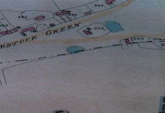
Calling at The White Cottage at the corner of Curtis Road and Leverstock Green Road on 29th July 2004, the owner told me she knew little about the history of the house, other than the land registry had documentation dating back to 1830. She also had a copy of an old postcard dated 1907 which she kindly let me scan. They had only lived in the house about 3 years. Given the information she had passed on, together with a careful look at the map sequence available for the site, I feel fairly certain that the sketch was of a cottage effectively “above” the existing building. The Tithe map for 1840 shows a ground plan which matches fairly well to the sketch. (See below) Assuming it is cottage and gardens no 238 on the St. Michael’s Tithe, then 33 years after Charlotte made her sketch, the property was owned and occupied by Thomas Orchard.
BELOW LEFT: 1840 Tithe map (St. Michaels)
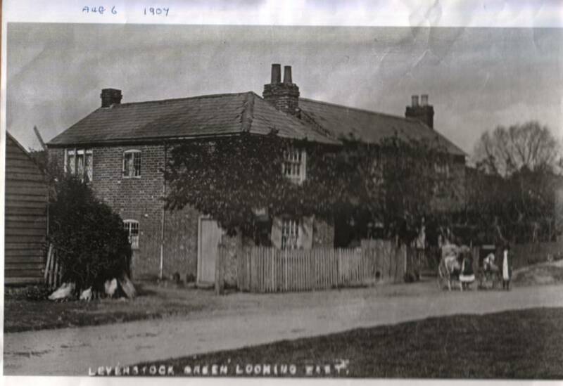
BELOW: 1907 postcard White Cottage.
An early OS map shows that between 1840 and the end of the century the cottage is enlarged into one much larger building, or more likely, several terraced dwellings. But between the 1877 & 1897 the easterly outshut appears to have been removed, and by the 1924 maps, the profile has changed yet again, and this time, the shape is that of the cottage shown in the photo of 1907, a single cottage placed further foreward opon the green. The original builiding shown in the sketch, no longer there, BUT the land was all part of the same property which is why the land registry had a date as early as 1830 for the property.
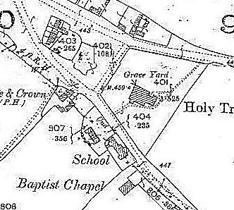
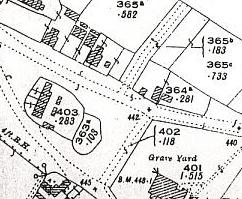
LEFT: O.S. 1877 extract
BELOW: O.S. 1897 extract.
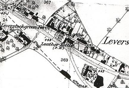
BELOW LEFT: O.S. 1924 extract.
Both the 1907 photo and the 1924 map show it in its present position adjacent to the road. The 1924 map also shows the barn visible in the photo and the early stages of the development of Curtis Road, with the roadway in place..
I think we can therefore reliably conclude that the original cottage was enlarged by 1877, partly demolished by 1897 and wholly demolished by 1924, but tenure of the land on which it stood can be reliably traced, so that the right of title to the land has been established as far back as 1830.