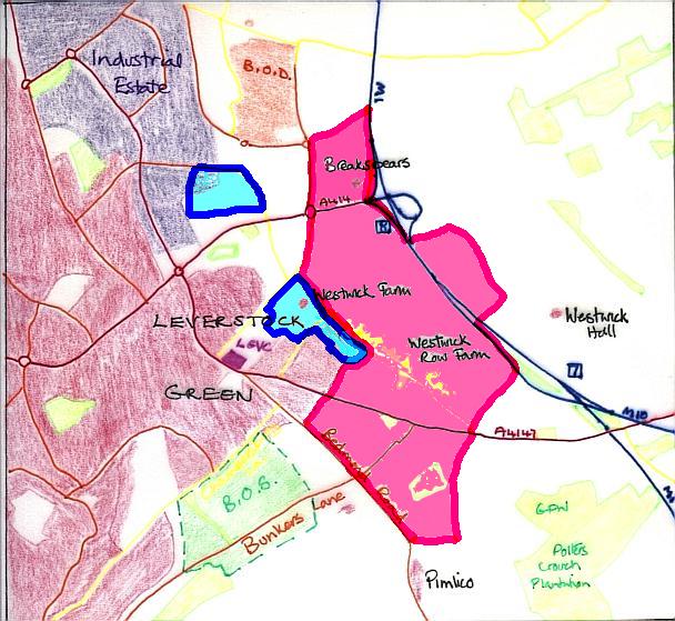
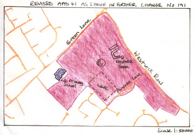
During the past 12 years the known recorded archaeology of the area of Leverstock Green, and in particular the area adjacent or close to Westwick Row has been greatly increased. By October 2000, as can be seen by the first of the maps below, this area was looking very "busy" archaelogically. As a result of this increase in knowledge, and representations made by the Barbara Chapman, virtually all of the undeveloped land surrounding Westwick Row is now either officially part of an Area of Archaeological Significance (No 61 DBC), or is being considered by St. Albans Council for such designation. (See maps below.)
Recent exciting finds (autumn 2006) discovered adjacent to Junction 8 of the M1 will add considerably to the known record, but it will be sometime before the full report is published, and I shall not radically overhall the archaeology pages until all the details are in and the SMR updated.
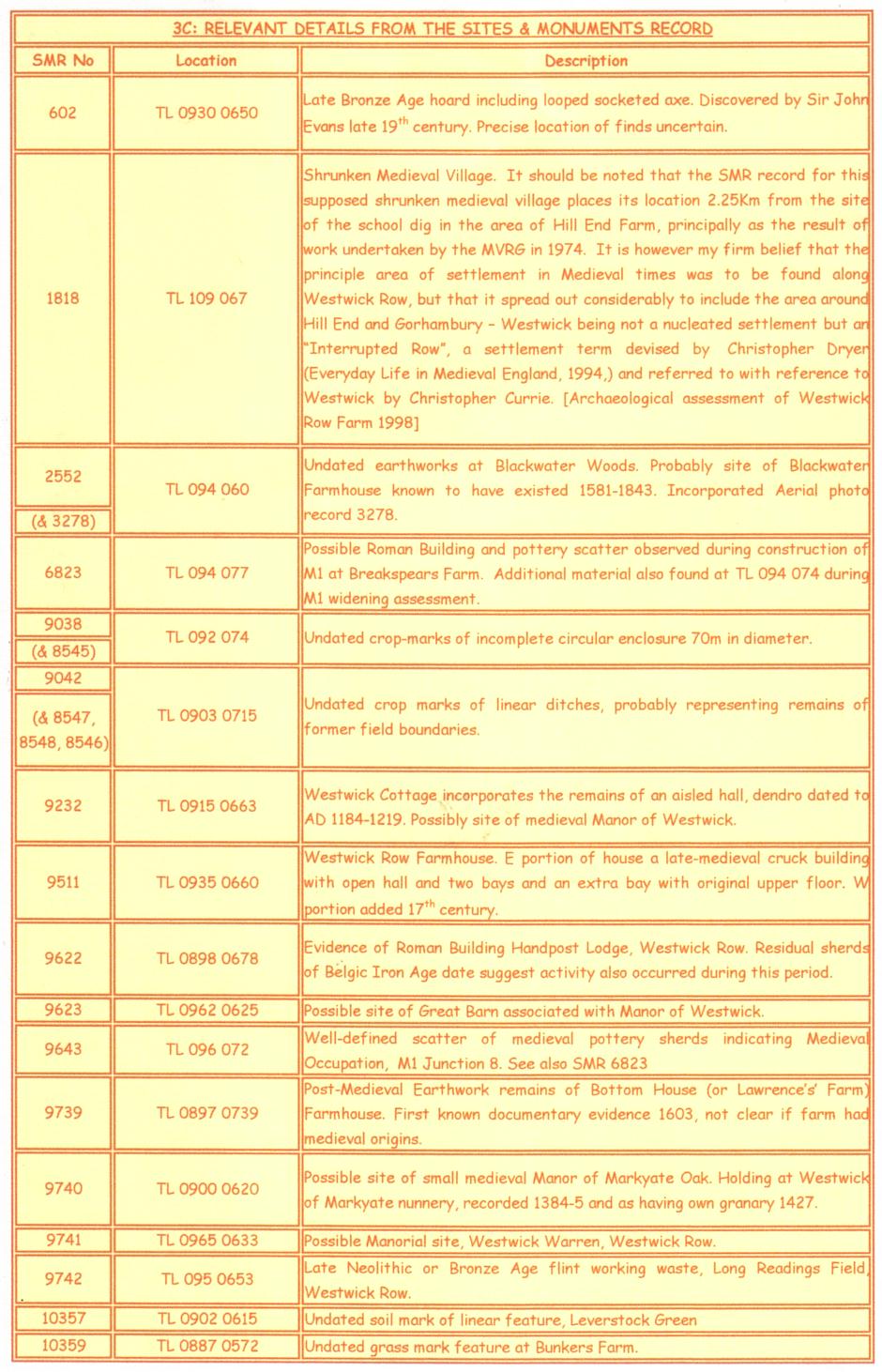
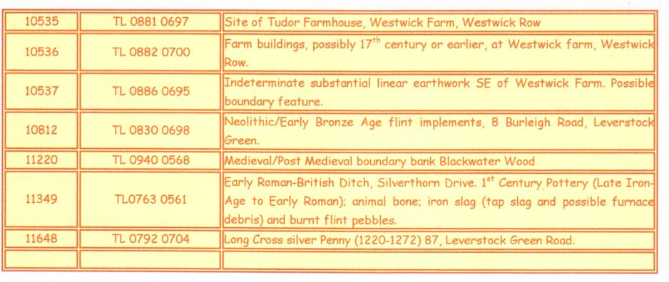
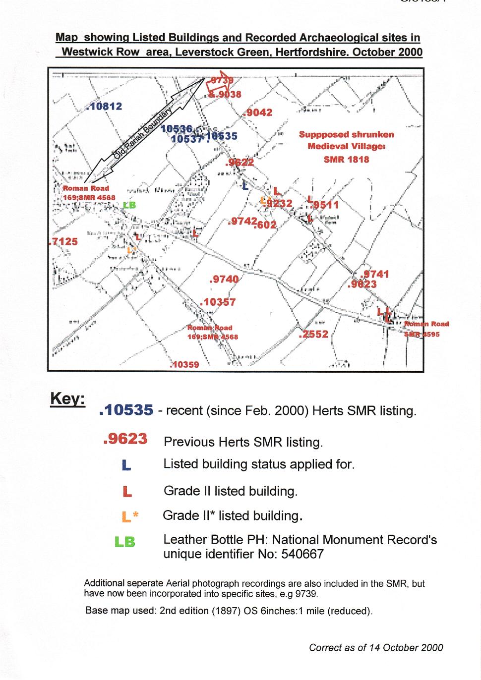
There is considerable recorded archaeology within 2Km of the Village Centre. In addition Roman Verulamium (St. Albans) is situated about 4.5 Km from away, and there are a number of “high status” Roman villas known within its hinterland, including Gorhambury, Boxmoor and Gadebridge; furthermore recent excavations along Westwick Row (SMR 9622) also suggest a high status Roman building or villa within 0.4Km of the dig site. The table below gives a brief breakdown of the known archaeological sites within the immediate vicinity of the dig site and as shown by Figure 11. (Aerial photos now incorporated shown in brackets.) It should also be noted that Dell Cottage, Westwick Row was afforded Grade II Listed Building status in July 2002, and that the Inspector to the recent Public Inquiry recommended that DBC should “append an extra requirement to address the need for the existing buildings at Westwick Row to be surveyed and those of either architectural or historical merit to be retained.” It is believed he was referring here not just to Dell Cottage but also to the buildings at Westwick Farm .