THE "DARK" AGES
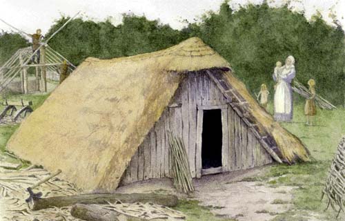
There is unfortunately little material evidence as yet uncovered to show how people lived in this area during the "dark ages". This does not necessarily mean that between the end of the 4th century when the Romano-British villas and the Temple-mausoleum were in decline, and the 10th century when there is some evidence to show that the area was to a certain extent cultivated and of importance, that there was a break in the cultivation of the area. In fact, the very fact that settlement is known to have occurred along Westwick Row during Roman times, and was almost certainly established during the Saxon period, with the early medieval Manor being based along Westwick Row as we now know, shows remarkable continuity. In all likelihood there was never a time from the Roman occupation to the present day when the area wasn't both settled and farmed. (Chambersbury Lane and its associated field boundaries seem to date back to this time, and the Manor of Westwick was of definite importance from the mid 10th century onwards)
Jonathan Hunn goes on to add in his report, [S167], that declining population and reduction in the intensity of land use would have meant an increase in waste land and secondary growth of woodland. Arable land may have been less intensively cultivated as a result of extended fallow periods, and there would have been a fluctuation in the balance between pasture and arable land.
Generally the countryside would have retained much of the same overall appearance as in earlier times. Traditional agricultural systems would probably have continued, though on a less intensive scale. Land probably remained fallow for longer periods and after several generations the pace of farming slackened and new traditions of less intensive farming developed. A dispersed pattern of settlement appears to be historically and archaeologically the tradition in the area in the vicinity of St. Albans, and this pattern is likely to have existed in the post-Roman and Saxon period. [S167 pp 56-58] Indeed, Jonathan Hunn shows quite an extensive growth of woodland in the area immediately to the east of Green Lane, above its junction with Buncefield Lane, and similarly shows woodland covering the area between the Bedmond Road and the Hemel Hempstead Road.
[ S167, Fig.71, p.173]
Christopher Currie has recently suggested that Westwick Row and the neighbouring lanes can be defined as a settlement type known as an Interrupted Row, and owing its origins to the Saxon era. A type defined and coined by Christopher Dyer in his work on Pendock in Worcestershire. [S312 pp47-76; S327]
THE SITES & MONUMENTS RECORD (SMR)
In the above text I have several times referred to the SMR followed by a number. e.g. Breakspears SMR 0775. This is a record of all the known archaeological sites, finds, earthworks and so on, collated on a county basis and maintained by the county archaeologist. Each site or find is given its own number. This is not quite the same as the scheduled ancient monuments list, SAM which is on a par with the listed building schedule with which we are all more familiar. Sites which are scheduled are deemed to be of national importance, and permission has to be gained before anything can be done on such sites. At the moment only a very small percentage of known sites are scheduled as monuments ( the Bronze Age Barrow at High Street Green is scheduled, as is Nicholas Bacon's Gorhambury), although a big programme is in hand to add large numbers of other sites in the next few years.
The Hertrfordshire SMR for a given area is available to any Hertfordshire resident upon request from the Country Archaeological Records Officer, Alison Tinniswood. Telephone 01992 555245, or e-mail at alison_tinniswood@hertscc.gov.uk
For a map showing the listing of sites around the central Leverstock Green Area in October 2000, click here.